A morning sky looks clear, but by afternoon clouds are building above the fields. Memorizing cloud names helps with recognition; understanding what makes air rise helps you ask what might happen next. Begin with heat, moisture and the atmosphere around a rising parcel of air.
The examples here are simplified study problems for private pilot students. They explain processes, not the weather along a real route. For the wider subject, use the FAA's Aviation Weather Handbook, FAA-H-8083-28B.
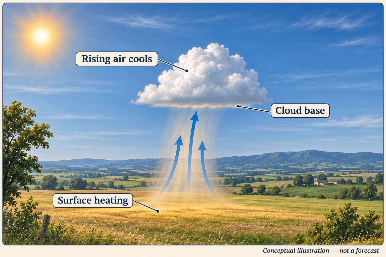
AI-generated concept illustration. The arrows show a simplified lifting process, not measured airflow or a forecast cloud base.
Start with uneven heating and lift
Sunlight heats surfaces unevenly. Air warmed near the ground can become buoyant relative to surrounding air. As it rises into lower pressure, it expands and cools. Terrain, fronts and converging air can also provide lift. The National Weather Service's basic weather explanation connects these mechanisms with cloud development.
Imagine two neighboring surfaces on a sunny day: a field that warms quickly and a cooler lake. In a notebook, sketch a possible rising current above the field. Then ask what you still need to know before predicting a cloud. The temperature alone is insufficient; moisture and the vertical structure of the atmosphere matter too.
Follow a parcel as it cools
In the simplified unsaturated parcel model, rising air cools at roughly 3°C per 1,000 feet. Once saturation occurs, condensation releases heat and the cooling rate becomes slower and variable. NOAA's parcel theory lesson explains the assumptions behind this model.
For an invented arithmetic exercise, start an unsaturated parcel at 24°C. Lift it 2,000 feet while assuming it remains unsaturated throughout. Its approximate temperature becomes 24 − (2 × 3) = 18°C.
That result does not locate the cloud base. We did not specify the parcel's moisture, and its dew point also changes during ascent. Write down the missing information before reaching for a cloud symbol. Treat the parcel rate separately from the actual environmental temperature profile.
Use temperature and dew point as a clue
Dew point is the temperature to which air must be cooled, at constant pressure and moisture content, to reach saturation. A narrowing temperature–dew point spread signals increasing relative humidity. The FAA handbook explains why surface cooling toward the dew point can matter for fog.
Suppose an invented evening observation gives a temperature of 15°C and a dew point of 14°C. Compare that one-degree spread with an earlier observation of 20°C and 14°C. The spread has narrowed, so investigating cooling and fog potential becomes useful. It does not prove that fog will form at a particular time. Wind, cloud cover, moisture changes and local terrain also matter.
Write a briefing question instead of a forecast: “Do the latest observations and forecasts support decreasing visibility during my return?” Then use weather services to investigate it.
Stability determines what happens after the push
Compare the parcel with its surroundings at the same height. A parcel warmer than its environment tends to remain buoyant; a cooler parcel tends to resist further upward displacement. NOAA's stability lesson offers a useful visual explanation.
In a hypothetical comparison, put our 18°C parcel into surroundings at 16°C, then repeat with surroundings at 20°C. Explain why the tendency differs even though the parcel temperature is unchanged. This comparison is the start of reasoning about vertical development, not a complete thunderstorm prediction.
Fronts can lift air as air masses meet. For a study sketch, draw warm air being lifted over colder air, then ask how moisture and stability could change the resulting clouds. Avoid assuming every front produces identical weather.
Turn theory into a pilot's question
For each weather feature, write three lines: the process you think is occurring, the observation or forecast that could support it, and the uncertainty that remains. This makes a useful discussion with your instructor before applying the VFR weather minimums guide.
In free flight, use a weather preset to practice identifying cloud position relative to the aircraft. The preset is a practice scene; it does not validate a forecast or replace a briefing. Compare it with the visibility and cloud-clearance example.
Sources checked: November 14, 2026. Temperatures, observations and parcel examples are invented. The image is conceptual, and the parcel calculation assumes unsaturated ascent throughout.